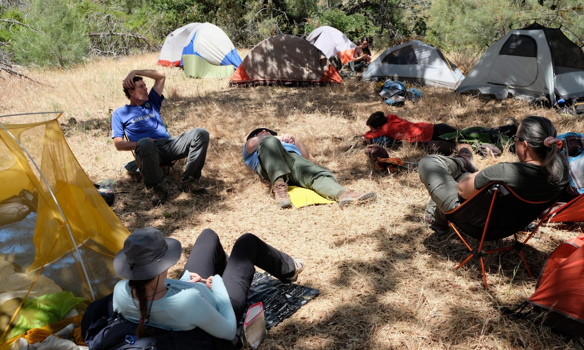
A starter to moderate overnight, close to home. Good for those gaining experience. Destination is a SVMBC facility so has water and toilets. Shady, and with reliable water at start and finish makes this a good summer option.
Key info
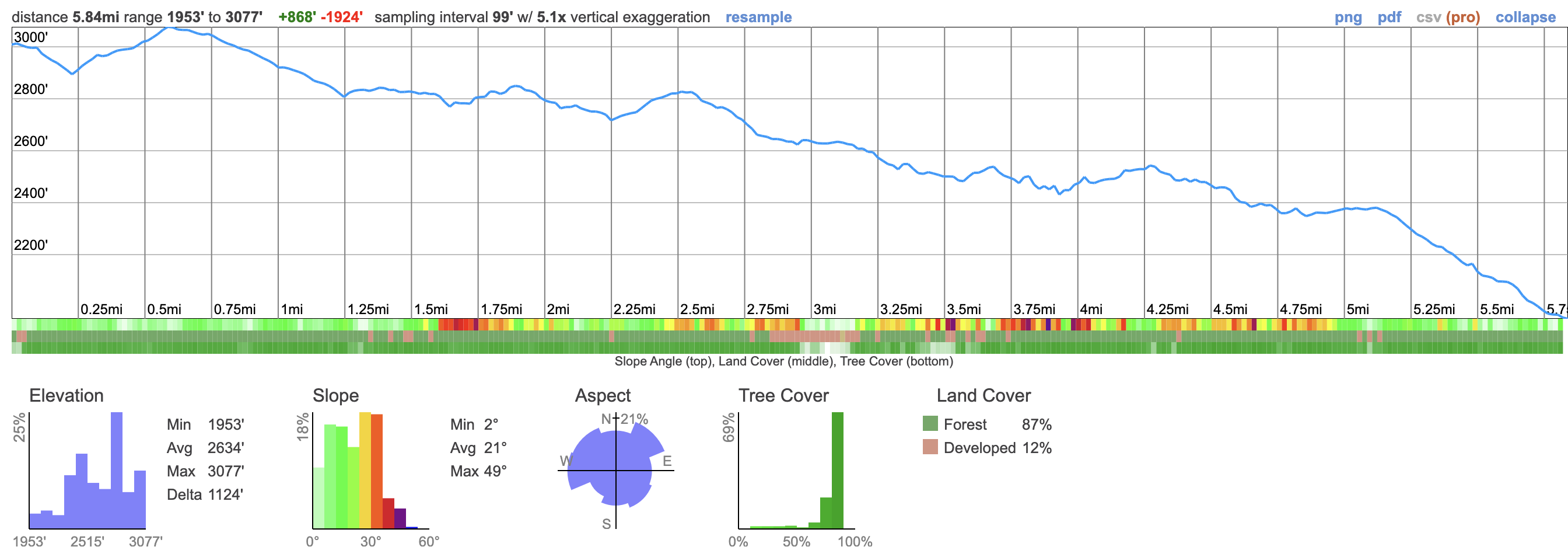
- 5.8 miles trail distance (each way)
- ~1,000 foot drop between start and finish (relatively gradual)
- Water: reliable fountain / facuets at start and finish, non en-route
- Shade / tree cover nearly the entire way
- Can easily accommodate up to 20 (if booked ahead)
Logistics
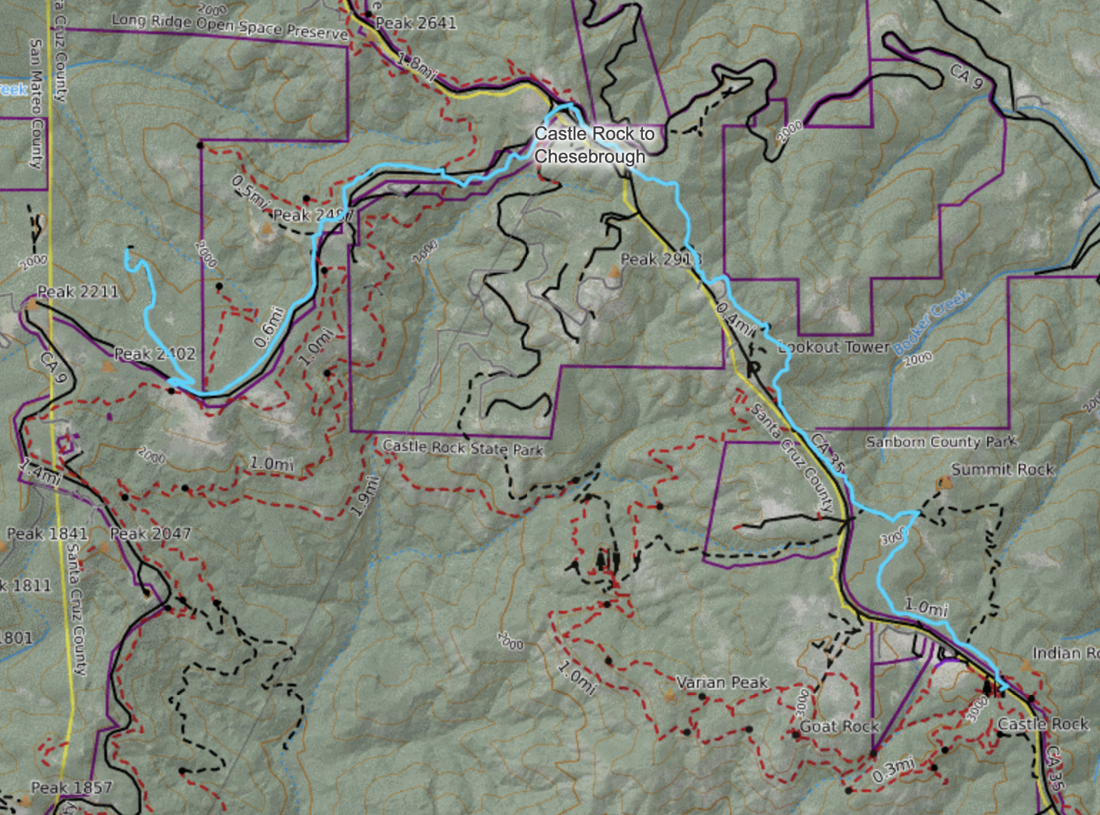
Start: Castle Rock State Park carpark. Arrive early, for opening, at the main (new) car park and request access to the old/overflow carpark (0.5km further south) where overnight parking is.
Finish: Camp Chesebrough through SVMBC (Shingle Mill, lower campsite, may have more availability). It may be possible to gain vehicle access, but that should be planned in advance if required.
Maps
Caltopo Map (use for planning and printing)
Tips & insights
- At the four-way trail junction 1 mile from the Castle Rock parking lot, go hard left and downhill, NOT straight. Straight will take you to Summit Rock. (this is a tricky junction)
- At the junction of Hwy 9 and Hwy 35, cross Hwy 35 heading east, pass the highway signs on the left verge of the road and you will see the trail continuing east (again tricky as the trail is not evident)
- There is also a tricky trail junction as you get about 1.5 miles from Chesebrough, here. You come into a parking laybay – the trail continues on the other side – don’t cross the highway,